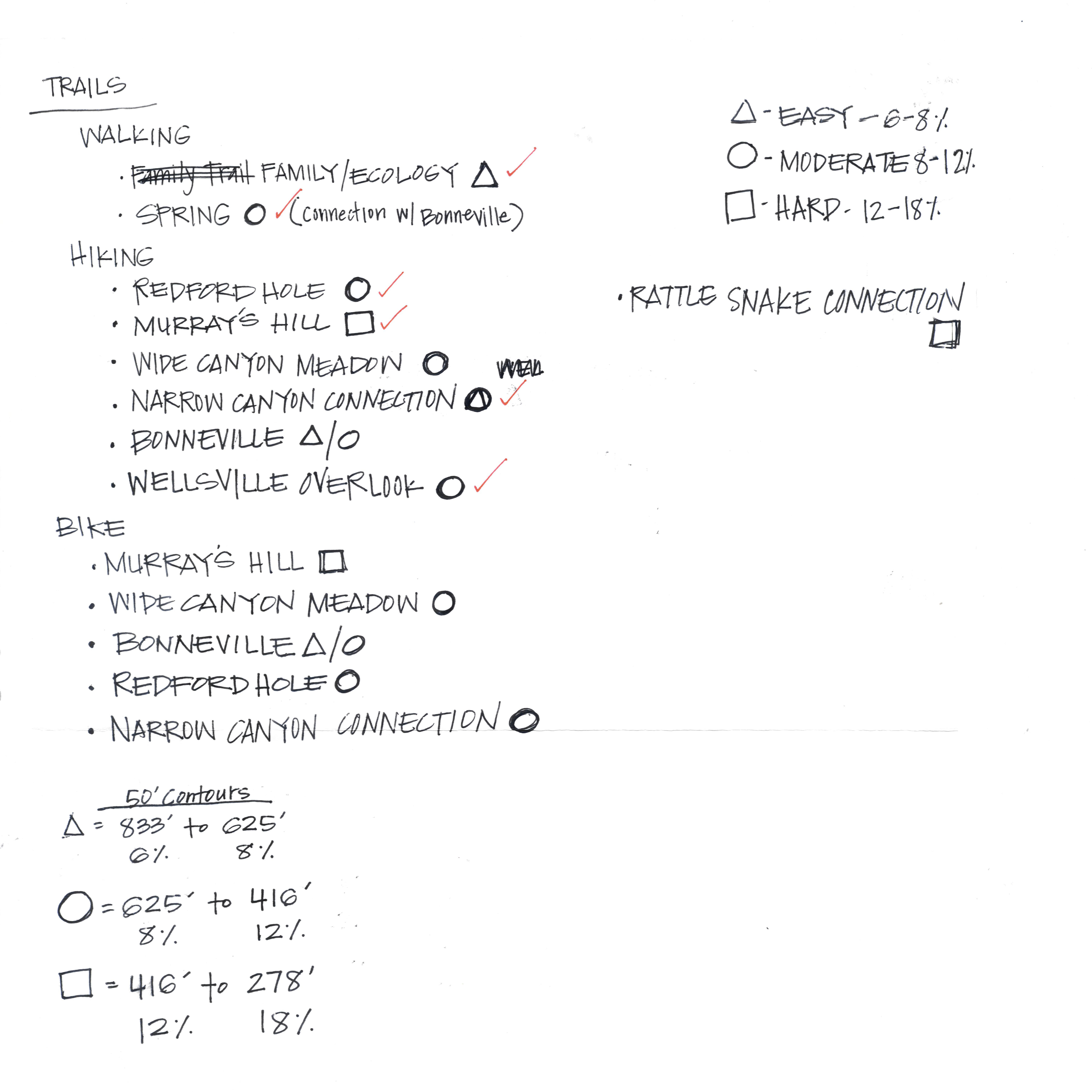
This was one of my favorite projects to work on. I elected to make sure that all of the trails that I was showing on my plan were the correct slope, which required that I research what slopes were appropriate for the various users that would be found on-site. These notes show my calculations and trail configurations that were added to my final design.

To ensure my trails were the correct grade I used ArcGIS to create a map showing the slopes and contour lines. Using this information I was able to place my trails in the appropriate areas for the difficulty I was trying to achieve.
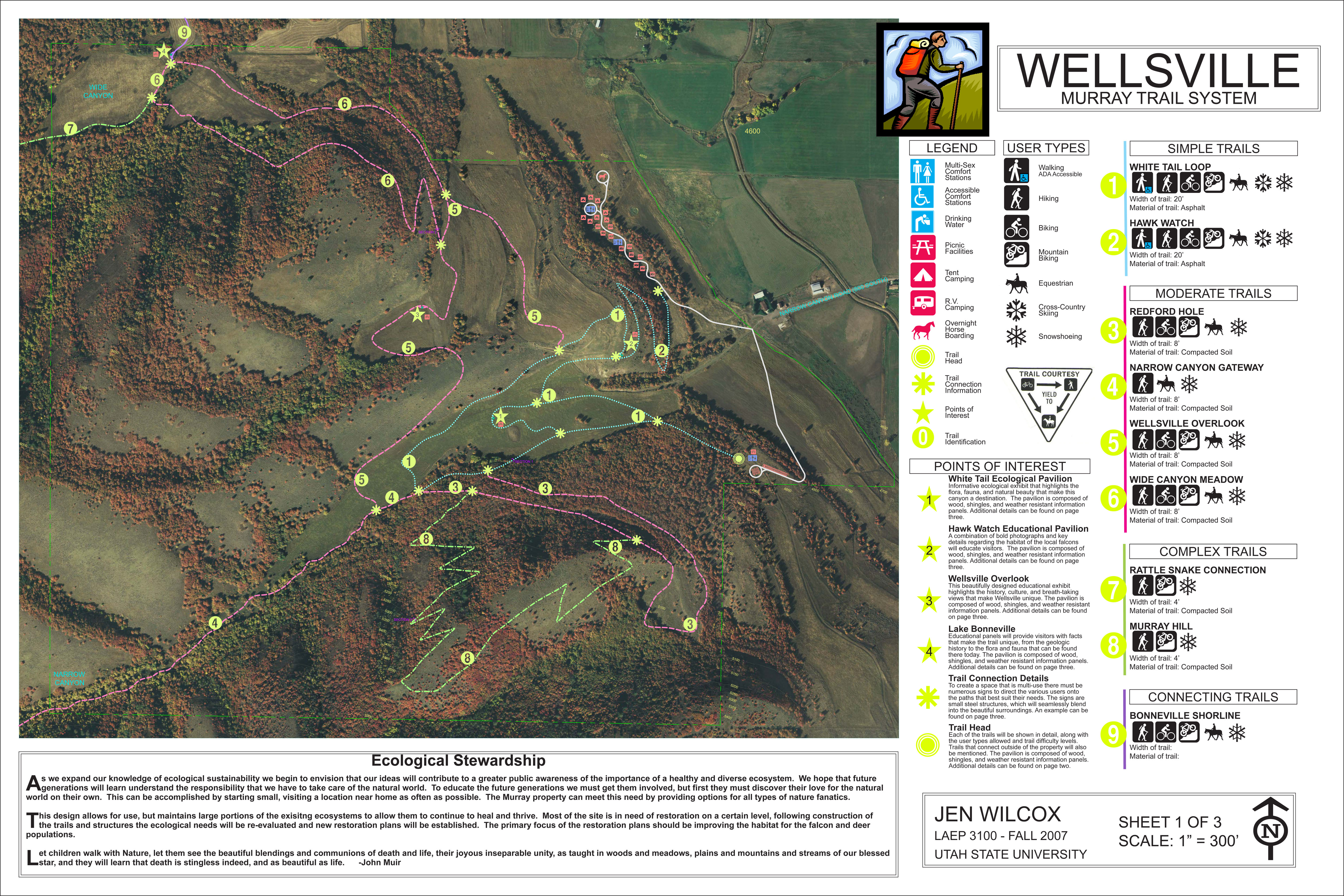
This project was a great combination of computer and hand graphics. The page layout was a favorite due to my choice to use the bright icons to identify different areas on the map. It was a great learning experience to learn about the construction and maintenance of trail systems, and the process used to layout campground areas.