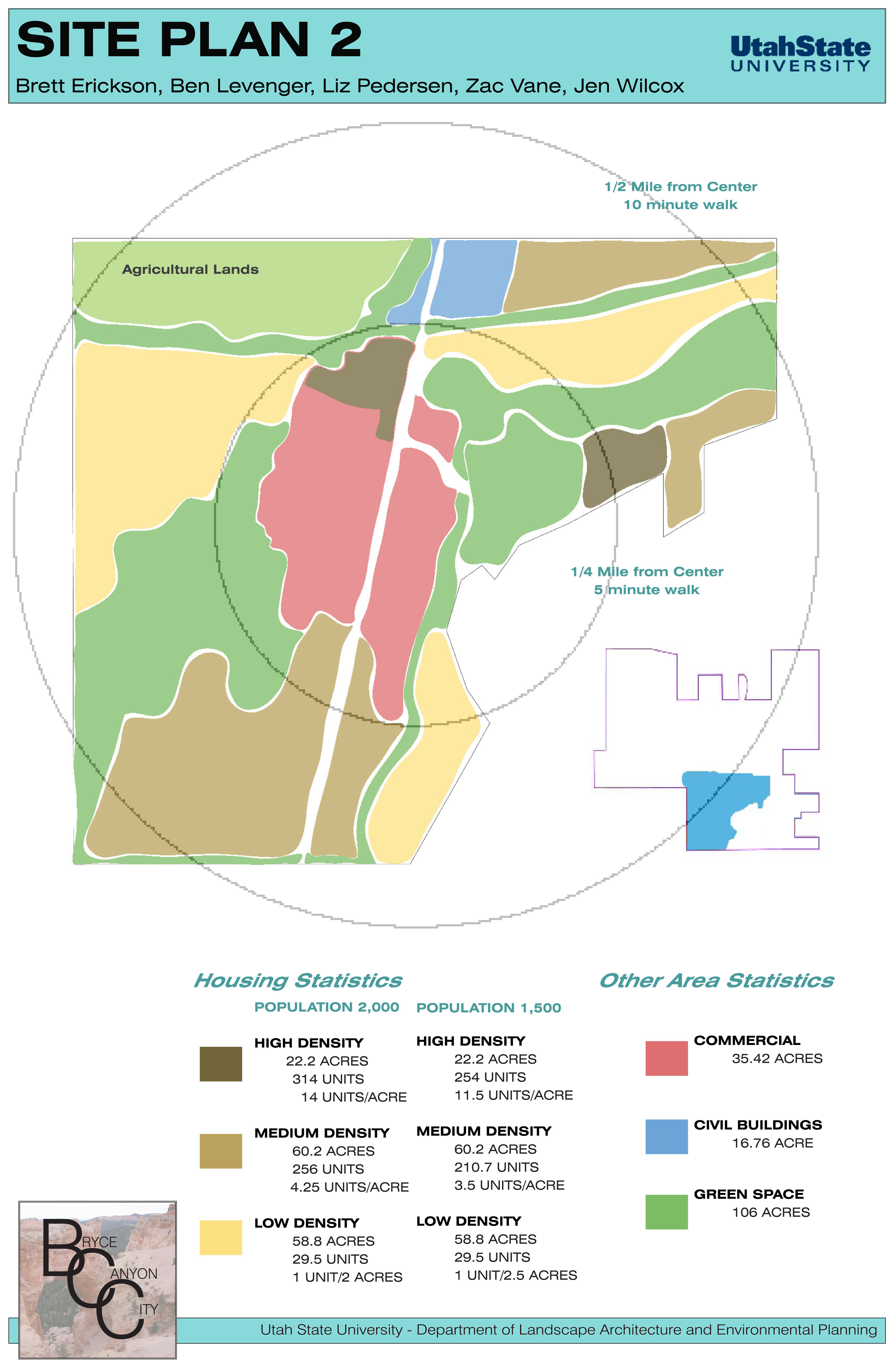
Due to the scale of this project it was split into two sections. The first portion was a group project that required us to develop a zoning map for the area. I assisted my group by creating a map in ArcGIS that displayed the site elements that should be considered, such as fault lines. (Shown Below) With this map we began to divide the site into sections showing where development would start, and how the city should grow. We then selected the first section and divided that into various development regions, such as civic, residential (high, medium, low), and commercial. (Shown to the Right)
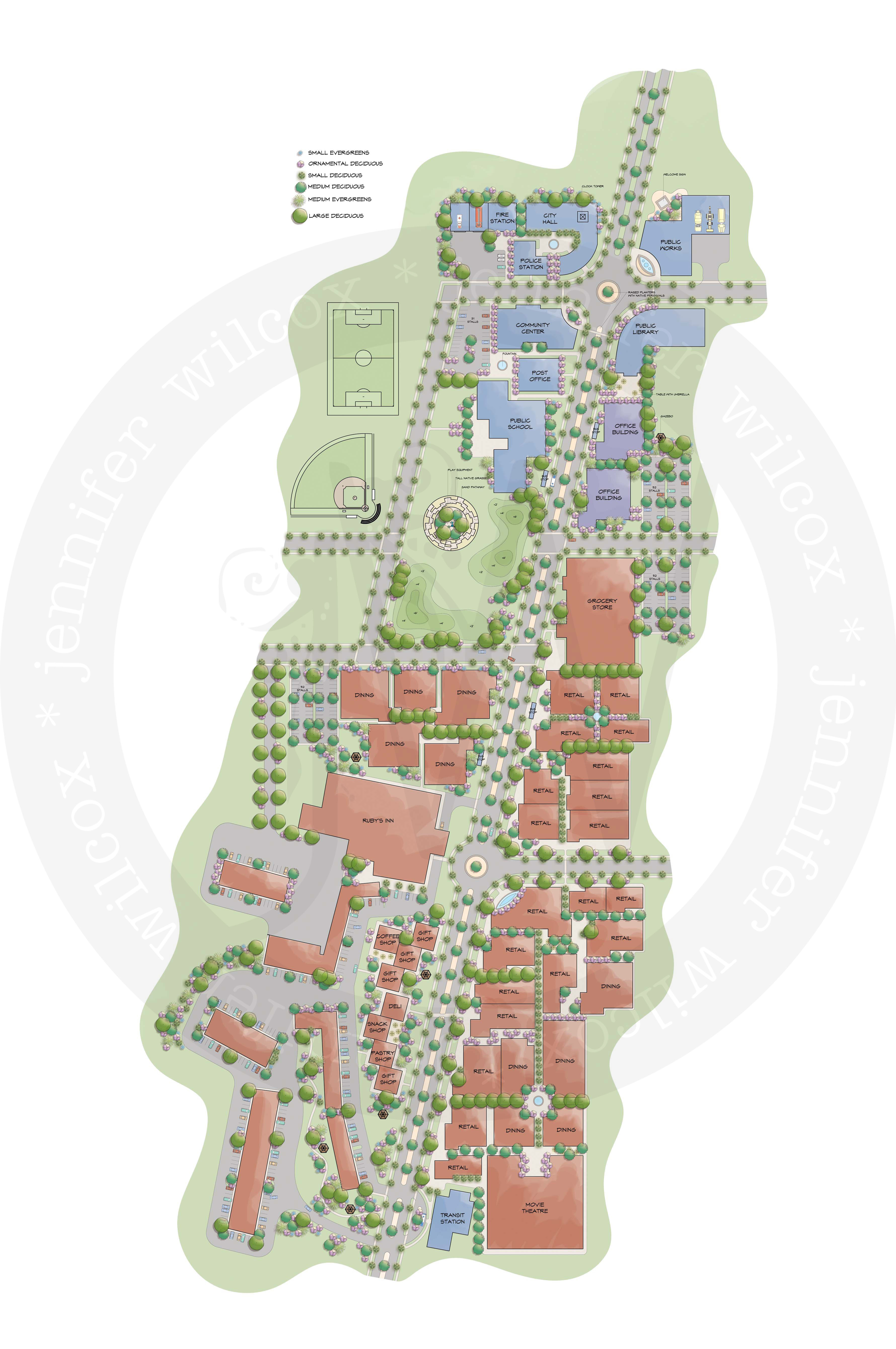
The second portion of the project was individual, and required that we each selection a portion of our development and detail it further. Our group decided to each take a portion of the first development region so they could be combined later for a comprehensive plan.
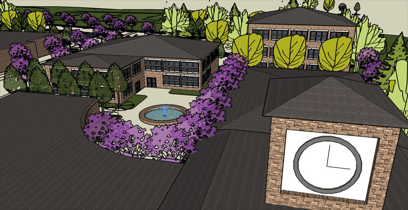
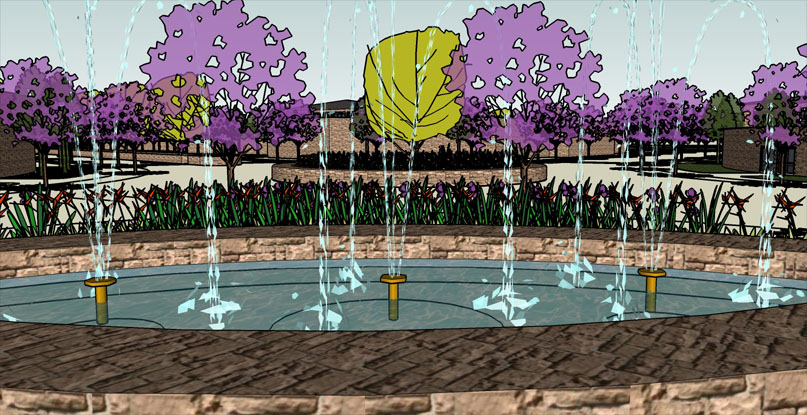
I worked to create a gateway that would provide a sense of arrival. I strived for a walkable community that would be comfortable for not only the residents, but also attract the tourists visiting the park.
The plan was designed in AutoCAD, rendered by computer, and modeled in SketchUp.